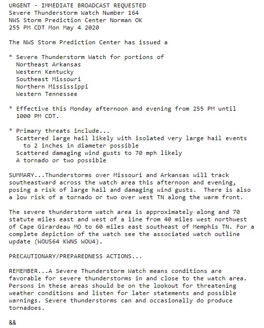
Weather Blog Post
Last Updated: May 04, 2020 7:44 PM
What you need to know.
** NOTE ** I moved the May 3rd event to another page. That way we could start fresh for the Monday afternoon and night event. If you want to view the Sunday event then go here https://cms.weathertalk.com/may-3-2020-severe-weather-live-blog-2/
Key Points
- A warm front will push northward through the area late Monday morning into the afternoon.
- Thunderstorms will develop this afternoon and that will last into the overnight hours (Monday).
- Thunderstorms are likely to accompany the front. Some storms could produce quarter hail and high wind gusts.
- The time-frame of the greatest risk will likely be between 3 PM and 11 PM.
- Have three or more ways of receiving your severe weather information. That includes my Beau Dodson Weather Talk app and a NOAA Weather Radio.
.
Call to action.
Monitor updated weather forecasts.
Make sure you are using the Weather Talk app. Download it from the app store. It is under Weather Talk.
TURN ON YOUR BEAU DODSON WEATHER TALK APP. Make sure it is on. Make sure you have not accidentally logged out of the app.
The app is for subscribers (please log into your account and make sure your payment has been updated. We have a large number of declined cards and PayPal payments.
Subscribe at www.weathertalk.com/welcome then go to your app store and search for WeatherTalk. Apple users click here. Android users click here
.
Forecast:
Updated at 7:45 PM
There are reports of strong and gusty winds behind the main rain band. This is called a wake low. It is caused by rapid pressure changes.
Typically, these winds can reach 30 to 40 mph. I am receiving reports of those speeds. I can't rule out occasional higher wind gusts. For the most part, these winds will remain in the 30 to 40 mph range.
They can last for 10 to 20 minutes.
Just be aware of this. These winds are not associated with severe thunderstorms.
.
Updated at 6:04 PM
Local Storm Report by NWS MEG: Caruthersville [Pemiscot Co, MO] social media reports HAIL of quarter size (E1.00 INCH) at 05:58 PM CDT -- hail up to quarter size.
Local Storm Report by NWS MEG: Humboldt [Gibson Co, TN] amateur radio reports HAIL of quarter size (M1.00 INCH) at 05:58 PM CDT -- quarter sized hail
Local Storm Report by NWS MEG: Holcomb [Dunklin Co, MO] broadcast media reports HAIL of quarter size (E1.00 INCH) at 05:30 PM CDT -
Local Storm Report by NWS MEG: Kennett [Dunklin Co, MO] broadcast media reports HAIL of quarter size (M1.00 INCH) at 05:38 PM CDT --
Local Storm Report by NWS MEG: Clarkton [Dunklin Co, MO] broadcast media reports TSTM WND DMG at 05:49 PM CDT -- powerlines down and tree damage.
Local Storm Report by NWS MEG: Wardell [Pemiscot Co, MO] broadcast media reports HAIL of ping pong ball size (E1.50 INCH) at 05:41 PM CDT -- ping pong ball sized hail reported in Wardell
.
Updated at 6:02 PM
For now, the risk of severe weather across the rest of SE Missouri, southern Illinois, and western Kentucky, is low. I will monitor some storms later mid-evening into the overnight hour.
The risk of severe with those storms will be fairly low. Maybe some hail reports.
.
Updated at 6 PM
The most intense thunderstorm is in NW TN. It has a history of wind damage.
West TN radar
https://weatherobservatory.com/radar_dyers.htm
.
Updated at 5:55 PM
Local Storm Report by NWS PAH: Gideon [New Madrid Co, MO] emergency mngr reports TSTM WND DMG at 05:25 PM CDT -- several homes damaged on anderson street in gideon. time estimated by radar.
Unconfirmed, reports of structural damage and buildings collapsed in New Madrid Co on S Anderson, E 4th and W 5th
Some damage in the bootheel area. Buildings damaged and a semi-truck blown over. All scanner traffic
Local Storm Report by NWS PAH: Poplar Bluff [Butler Co, MO] broadcast media reports FLOOD at 05:05 PM CDT -- ponding of low-lying streets in poplar bluff.
Local Storm Report by NWS PAH: Harviell [Butler Co, MO] broadcast media reports HAIL of quarter size (E1.00 INCH) at 04:51 PM CDT -- broadcast media relayed a viewer report of one inch hail.
Local Storm Report by NWS PAH: Harviell [Butler Co, MO] broadcast media reports TSTM WND GST of E70 MPH at 04:51 PM CDT -- broadcast media relayed a viewer report of estimated 70 mph winds. several trees down in the area. time estimated from radar.
Local Storm Report by NWS PAH: Harviell [Butler Co, MO] trained spotter reports TSTM WND DMG at 04:51 PM CDT -- large tree down. relayed via twitter.
Local Storm Report by NWS PAH: 5 W Ash Hill [Butler Co, MO] asos reports TSTM WND GST of M58 MPH at 05:00 PM CDT -- asos station kpof poplar bluff mo.
Carter/Ripley line on US 21 truck that has power lines on it power is out there. many trees down at that location.
Local Storm Report by NWS PAH: 2 S Grandin [Ripley Co, MO] trained spotter reports TSTM WND DMG at 04:26 PM CDT -- severe trees and power lines down including a tree on a house.
Power lines and trees down 1.5 miles South of Grandin< Missouri, also a tree on a trailer home there.
.
Updated at 5:51 PM
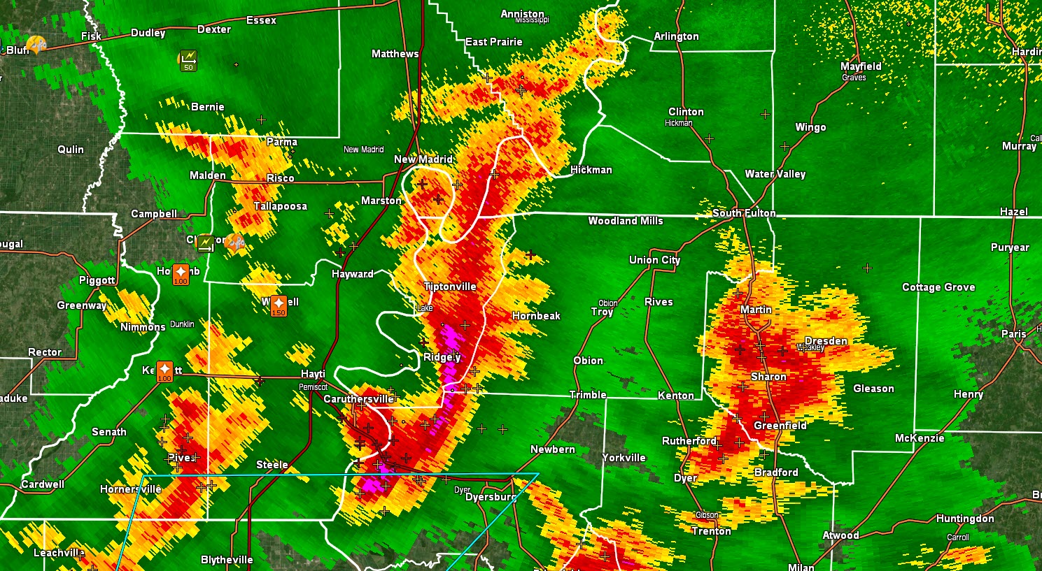
5/4/20 5:51 PM update. The most intense storms are now located from Central New Madrid County southward into Pemiscot County, MO. These storms are moving E SE at 50 mph.
Occasional wind gusts of 60 mph and quarter size hail are possible in the most intense portions of the thunderstorms.
The most intense cell was about to move into Lake County, TN.
Fulton County will be clipped by this thunderstorm cell, but the most intense portion will remain to your south.
Another area of strong thunderstorms was moving into Weakley County. These storms are currently sub-severe but could still produce strong and gusty wind and nickel size hail. They could pulse up a bit, thus be storm aware as they move east at 45 mph.
Another strong thunderstorm was entering southern Dunklin County, MO. The movement was SE at 50 mph.
Intense storms have ended, for the time being, over Butler and Stoddard Counties.
SE MO radar
https://weatherobservatory.com/radar_pbluff.htm
West TN radar
https://weatherobservatory.com/radar_dyers.htm
Updated at 5:20 pm
Local Storm Report by NWS PAH: 4 SW Dexter [Stoddard Co, MO] trained spotter reports TSTM WND GST of E50 MPH at 05:18 PM CDT -- https://nwschat.weather.gov/lsr/#PAH/202005042218/202005042218
Updated at 5:12 pm
Local Storm Report by NWS PAH: Harviell [Butler Co, MO] trained spotter reports TSTM WND DMG at 04:51 PM CDT -- large tree down. relayed via twitter. https://nwschat.weather.gov/lsr/#PAH/202005042151/202005042151
.
Updated at 5 pm
Numerous reports of hail and high winds in Butler County, Missouri.
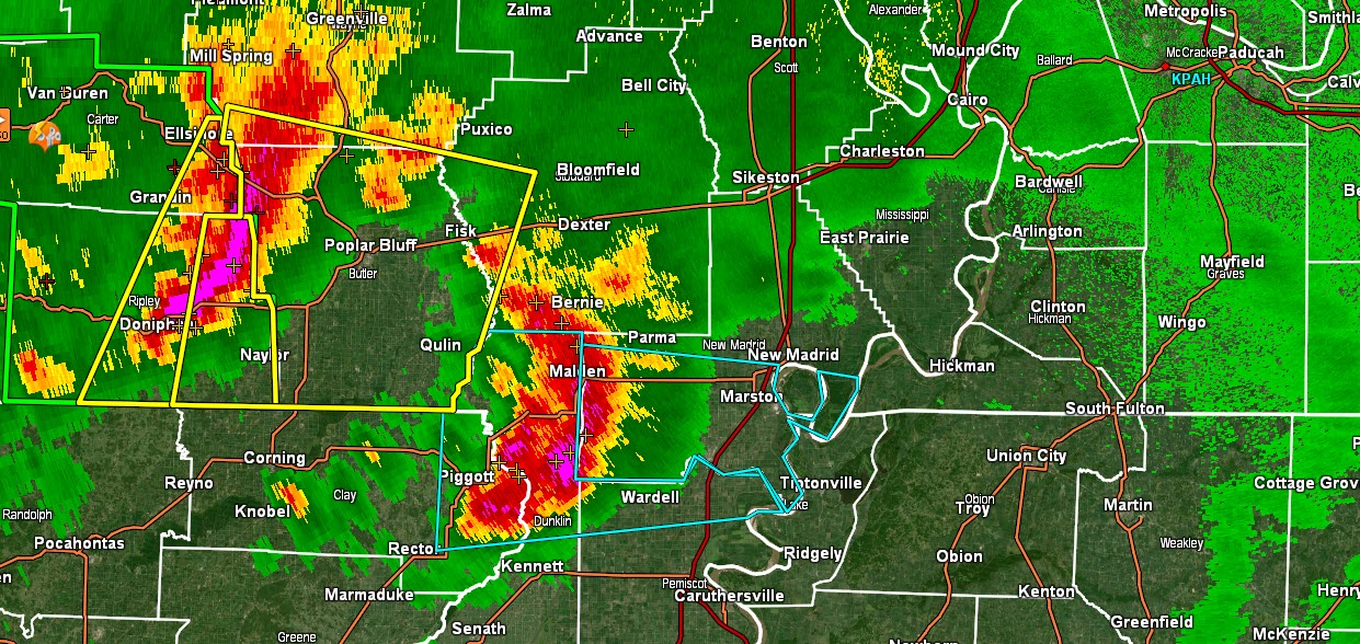
Updated at 4:37 PM
Butler, Stoddard, Dunklin, New Madrid, Pemiscot, Lake Obion, and Fulton Counties. Several bands of intense thunderstorms are moving across or into portions of these counties.
These storms are occasionally producing 60+ mph wind gusts and nickel size hail.
The storms are moving E SE at 50 mph.
At 4:36 PM the most intense storms were just entering western Butler County, Missouri, and another area over the northern half of Dunklin County.
Be alert for rapidly changing weather conditions.
Here is a radar to help track these thunderstorms.
https://weatherobservatory.com/radar_pbluff.htm
.
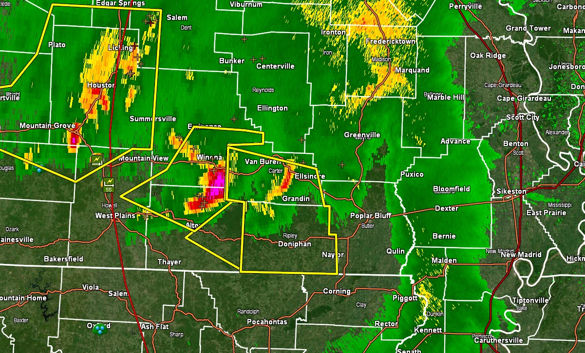
Updated at 3:20 PM
3:21 PM Butler and Dunklin Counties. A line of severe thunderstorms, with a history of widespread wind damage, is approaching from the west/northwest.
It is moving southeast at 50 mph. It is currently located in south-central Carter and northwest/north-central Ripley County.
This storm will continue to push towards Butler County. It will eventually also impact Dunklin County.
If it maintains its current strength, then 60 to 70 mph wind gusts and quarter size hail could occur along its track.
Radar
https://weatherobservatory.com/radar_pbluff.htm
.
Updated at 3:08 PM
I am watching these storms northwest of Butler County, MO. Those may impact your county. They are moving southeast. Hail and wind are the concern.
Yellow boxes are severe thunderstorm warnings.
Radar
http://weatherobservatory.com/weather-radar.htm
.
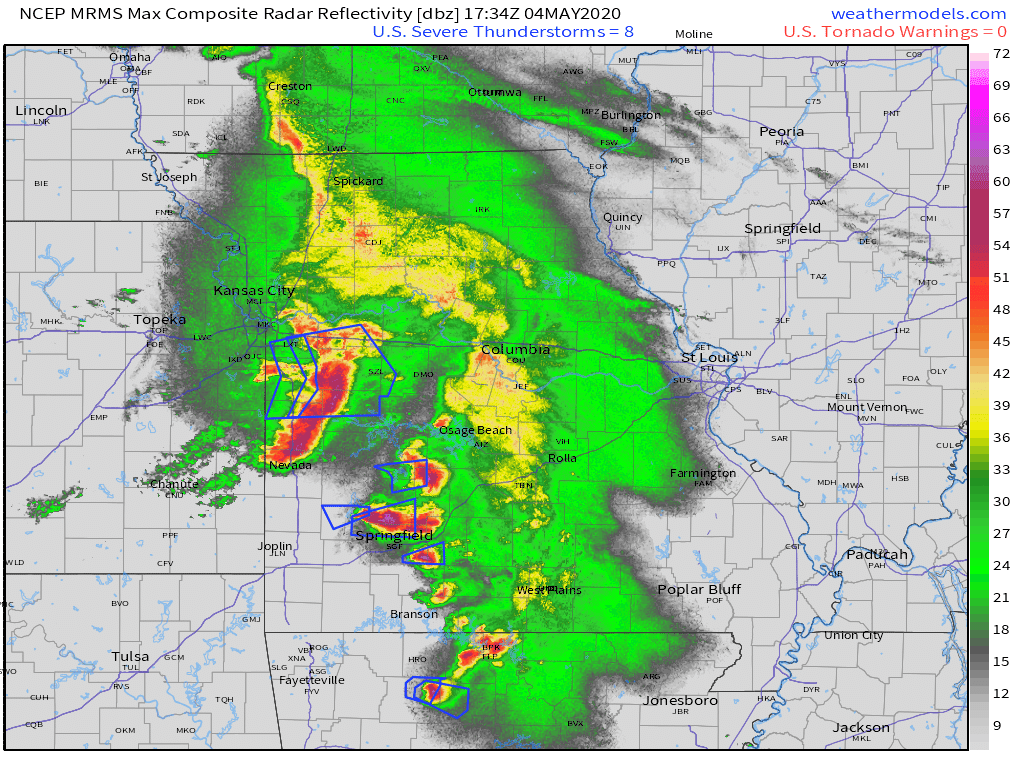
Updated at 3 PM
Severe thunderstorm watch boxes in red.
.
3 PM Bollinger, Cape Girardeau, Scott, and Mississippi Counties. Carlisle, Hickman, Fulton, Graves, and Calloway Counties. Weakley and Henry Counties.
Thunderstorms will push into the area over the coming hours. A few of these storms could produce high wind and hail.
The risk of severe weather will last into the evening hours.
I will send out more app messages if severe weather appears imminent.
Radar
http://weatherobservatory.com/weather-radar.htm
.
Updated at 2:45 PM
Butler, Stoddard, New Madrid, Dunklin, and Pemiscot Counties in SE MO. Lake and Obion County, TN.
Thunderstorms will push into the area over the coming hours. A few of these storms could produce high wind and hail.
The risk of severe weather will last into the evening hours.
I will send out more app messages if severe weather appears imminent.
Radar
http://weatherobservatory.com/weather-radar.htm
.
Updated at 1:45 PM Monday
Note: We added a "see all" button on the website. This allows you to see every message that I have sent out (to all my forecast counties).
Here is the link. Click here.
A rather messy severe weather set up this afternoon and evening.
Widespread showers and embedded thunderstorms have been tracking and expanding across much of Missouri.
This area of precipitation is moving east and southeast.
There have been embedded severe thunderstorms with hail and high wind.
There remain questions about the severe weather in our local area. The chance os higher over southeast Missouri and southwest Illinois. Other areas, should monitor.
The images below are time-sensitive and will be outdated in a while.
To view the live radars, visit these links.
Radars
Interactive city-view radars
http://weatherobservatory.com/weather-radar.htm
A third backup radar
https://weathertalk.com/morani
Clickable watches and warnings can be viewed on the local city-view interactive radars (link above). Be sure and turn on the warnings above the local radars.
A new regional radar we offer
https://imagery.weathertalk.com/prx/RadarLoop.mp4
Lightning data
https://wtalk.co/7QT7WHKU
.
Updated at 8:45 AM Monday
Severe thunderstorms are likely over at least southeast Missouri this afternoon and perhaps into portions of southern Illinois, western Kentucky, and northwest Tennessee.
There remains some uncertainty about just how unstable the atmosphere will become as you move further north and east in the region. Thus, the greatest risk is over southeast Missouri and then into southwest Illinois, far western Kentucky, and northwest Tennessee. Areas further north and northeast will need to be monitored.
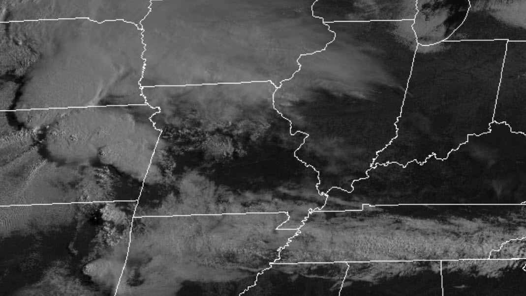
Satellite imagery this morning shows quite a bit of clear sky conditions in the region. This will help build CAPE. CAPE is basically energy for storms to tap into. Sunshine helps warm the ground. This helps build CAPE.
The Black area is clear sky conditions.
Note the white clouds in Kansas. Those are severe thunderstorms.
..
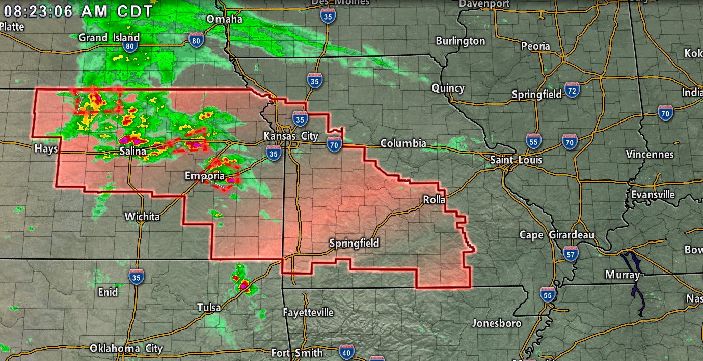
You can see those on this radar still. This image is from 8:23 AM.
The red box is a severe thunderstorm watch. Again, this is time-sensitive. It was taken at 8:25 AM.
.
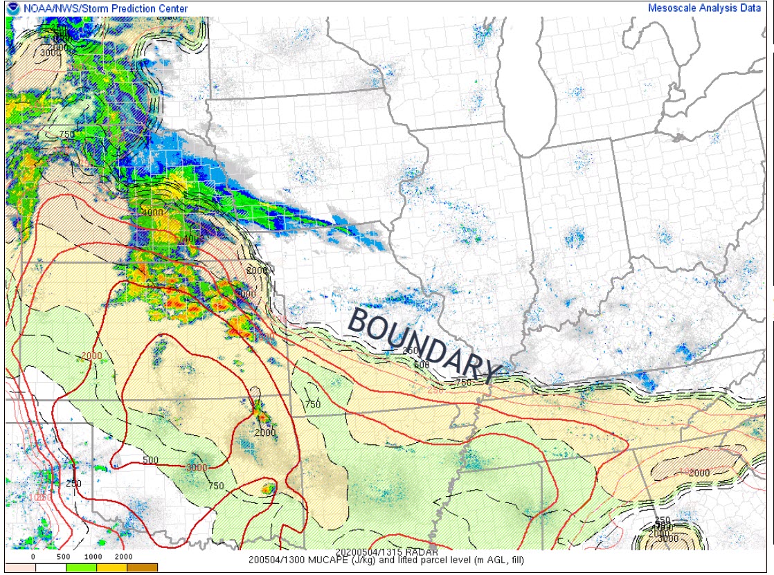
I will be monitoring a boundary today that will push north and northeast.
You can see that boundary on this MUCAPE graphic. The most unstable air is south of the boundary. As that shifts northward, later today, we will watch the atmosphere become more and more unstable.
How far north that boundary moves is key to today's severe weather threat.
The further north and northeast it travels, the more likely severe weather in our local area.
.
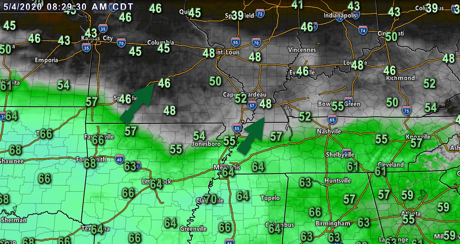
Dew point is another ingredient when considering severe weather. Dew points of 58 and above are typically necessary for severe thunderstorms. Not always, but as a general rule.
I will be watching these dew points as they spread north and northeast along the boundary.
Notice how the higher dew points are south of the boundary.
.
Future-cast radars
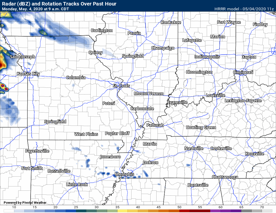
This animation is the Hrrr model.
This animation shows you what radar might look like as the next system pulls through the region. It is a future-cast radar.
Green is rain. Blue is snow. Pink and red represent sleet and freezing rain.
Time-stamp upper left. Click the animation to enlarge it.
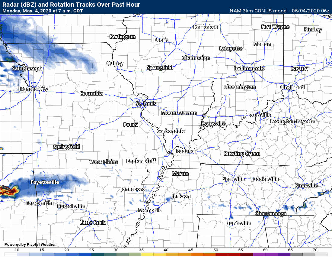
This animation is the 3K American Model.
This animation shows you what radar might look like as the next system pulls through the region. It is a future-cast radar.
Green is rain. Blue is snow. Pink and red represent sleet and freezing rain.
Time-stamp upper left. Click the animation to enlarge it.
.
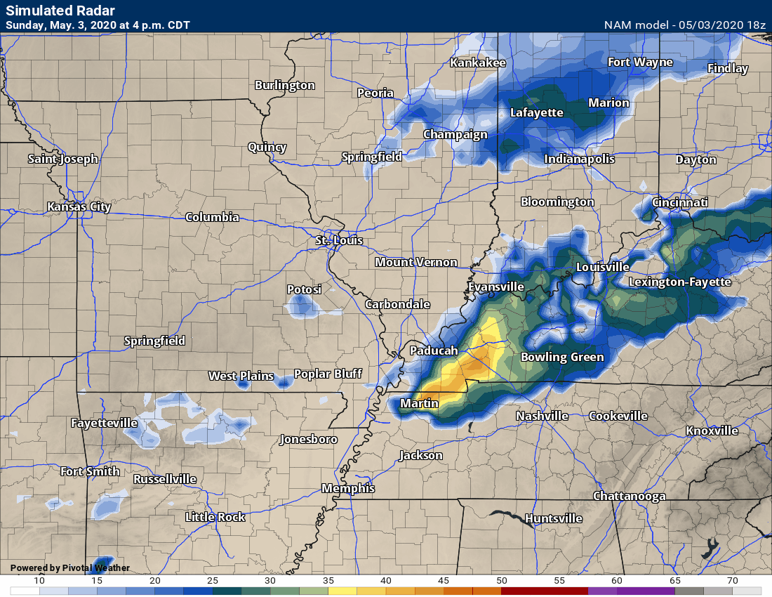
This next animation is the NAM American Model.
This animation shows you what radar might look like as the system pulls through the region. It is a future-cast radar.
Green is rain. Blue is snow. Pink and red represent sleet and freezing rain.
Time-stamp upper left. Click the animation to enlarge it.
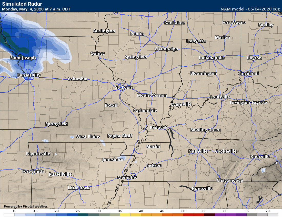
.
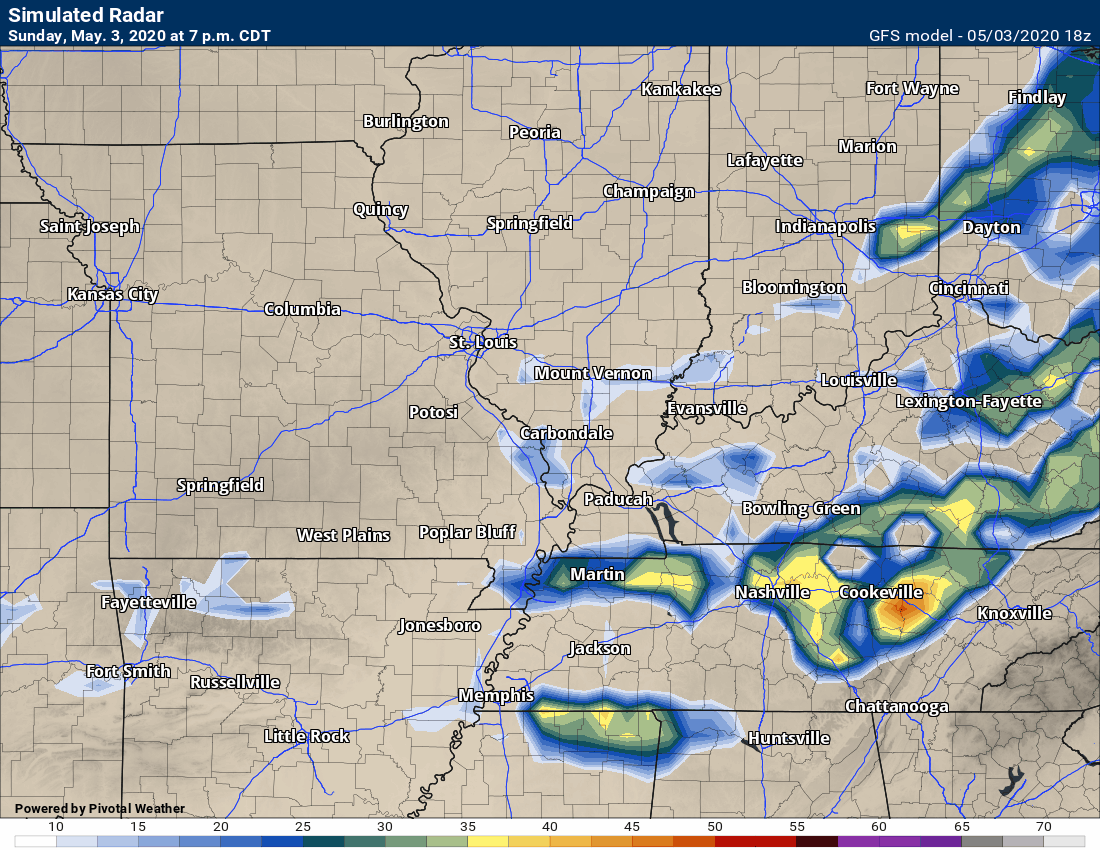
This next animation is the GFS American Model.
This animation shows you what radar might look like as the system pulls through the region. It is a future-cast radar.
Green is rain. Blue is snow. Pink and red represent sleet and freezing rain.
Time-stamp upper left. Click the animation to enlarge it.
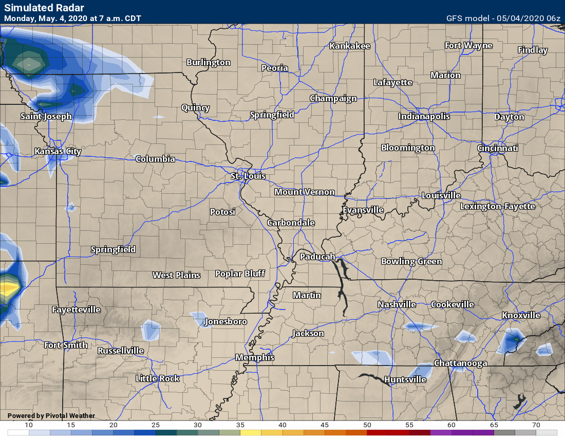
.
Updated at 6:30 PM. Sunday night. The next update will be Monday morning.
The cold front that has pushed to our south will return northward as a warm front. That warm front will set the stage for additional severe weather.
Additional severe thunderstorms are possible Monday afternoon and night. The primary concern will be wind damage and hail. The tornado risk will be low.
The risk appears to be higher over southwest Illinois and southeast Missouri. Perhaps into western Kentucky and northwest Tennessee, as well. This will partly depend on where the boundary sets up. Monitor updates. There may be shifts in the placement of the greatest risk zone.
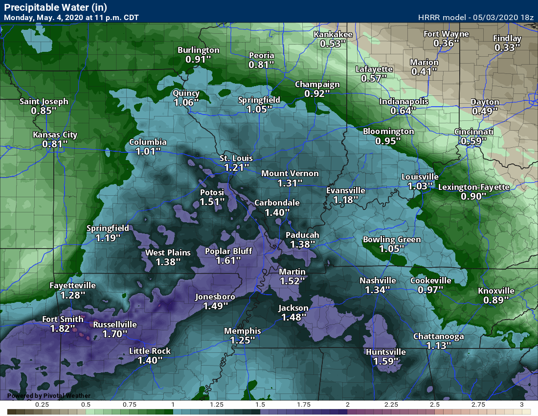
Rain and storms will continue on Monday night. Some heavy rain is likely to occur. There is no shortage of moisture in the atmosphere. Some locations will likely top an inch of rain.
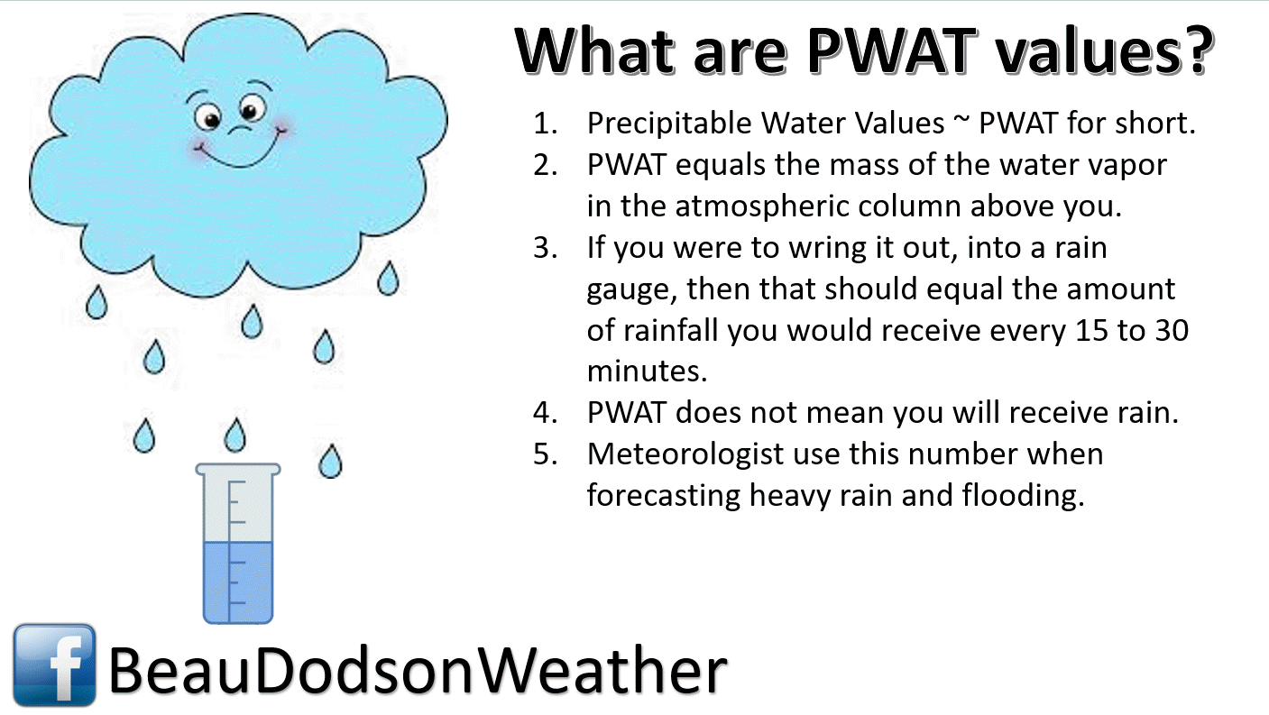
PWAT values will top 1.5". That is high for this time of the year.
.
Rain will taper late Monday night and Tuesday morning.
 .
.
Again, as a reminder, these are models. They are never 100% accurate. Take the general idea from them.
What should I take from these?
- The general idea and not specifics. Models usually do well with the generalities.
- The time-stamp is located in the upper left corner.
.
What am I looking at?
You are looking at different models. Meteorologists use many different models to forecast the weather. All models are wrong. Some are more wrong than others. Meteorologists have to make a forecast based on the guidance/models.
I show you these so you can see what the different models are showing as far as precipitation. If most of the models agree, then the confidence in the final weather forecast increases.
.
This animation is the Hrrr model.
This animation shows you what radar might look like as the next system pulls through the region. It is a future-cast radar.
Green is rain. Blue is snow. Pink and red represent sleet and freezing rain.
Time-stamp upper left. Click the animation to enlarge it.
This animation is the 3K American Model.
This animation shows you what radar might look like as the next system pulls through the region. It is a future-cast radar.
Green is rain. Blue is snow. Pink and red represent sleet and freezing rain.
Time-stamp upper left. Click the animation to enlarge it.
.
This next animation is the NAM American Model.
This animation shows you what radar might look like as the system pulls through the region. It is a future-cast radar.
Green is rain. Blue is snow. Pink and red represent sleet and freezing rain.
Time-stamp upper left. Click the animation to enlarge it.
.
This next animation is the GFS American Model.
This animation shows you what radar might look like as the system pulls through the region. It is a future-cast radar.
Green is rain. Blue is snow. Pink and red represent sleet and freezing rain.
Time-stamp upper left. Click the animation to enlarge it.
.
Radars
Interactive city-view radars
http://weatherobservatory.com/weather-radar.htm
A third backup radar
https://weathertalk.com/morani
Clickable watches and warnings can be viewed on the local city-view interactive radars (link above). Be sure and turn on the warnings above the local radars.
A new regional radar we offer
https://imagery.weathertalk.com/prx/RadarLoop.mp4
Lightning data
https://wtalk.co/7QT7WHKU
.
Storm Prediction Center severe weather outlook.
Here is the latest Storm Prediction Center outlook. Remember, don't pay too much attention to the different colors. Focus on the actual forecast. The forecast is for a few severe thunderstorms.
The black outline is our local area.
Light green is where thunderstorms may occur but should be below severe levels.
Dark green is a level one risk. Yellow is a level two risk. Orange is a level three (enhanced) risk. Red is a level four (moderate) risk. Pink is a level five (high) risk.
One is the lowest risk. Five is the highest risk.
A severe storm is one that produces 58 mph wind or higher, quarter size hail, and/or a tornado.

.
Tomorrow's severe weather outlook.

Not receiving app/text messages?
USE THE APP. ATT and Verizon are slowing or stopping the text messages.
Make sure you have the correct app/text options turned on. Find those under the personal notification settings tab at www.weathertalk.com. Red is off. Green is on.
Subscribers, PLEASE USE THE APP. ATT and Verizon are not reliable during severe weather. They are delaying text messages.
The app is under WeatherTalk in the app store.

Apple users click here

Android users click here
.


Live lightning data: Click here.